displaying 471 results

In the European Union, noise maps highlight the often overlooked impact of noise pollution on people’s health and well-being.

A new platform, built in partnership with Infosys Limited, enables staff to create apps designed to improve pipeline maintenance.

Generative AI tools are knocking down technological barriers. What skills do GIS practitioners need to cultivate to keep up?
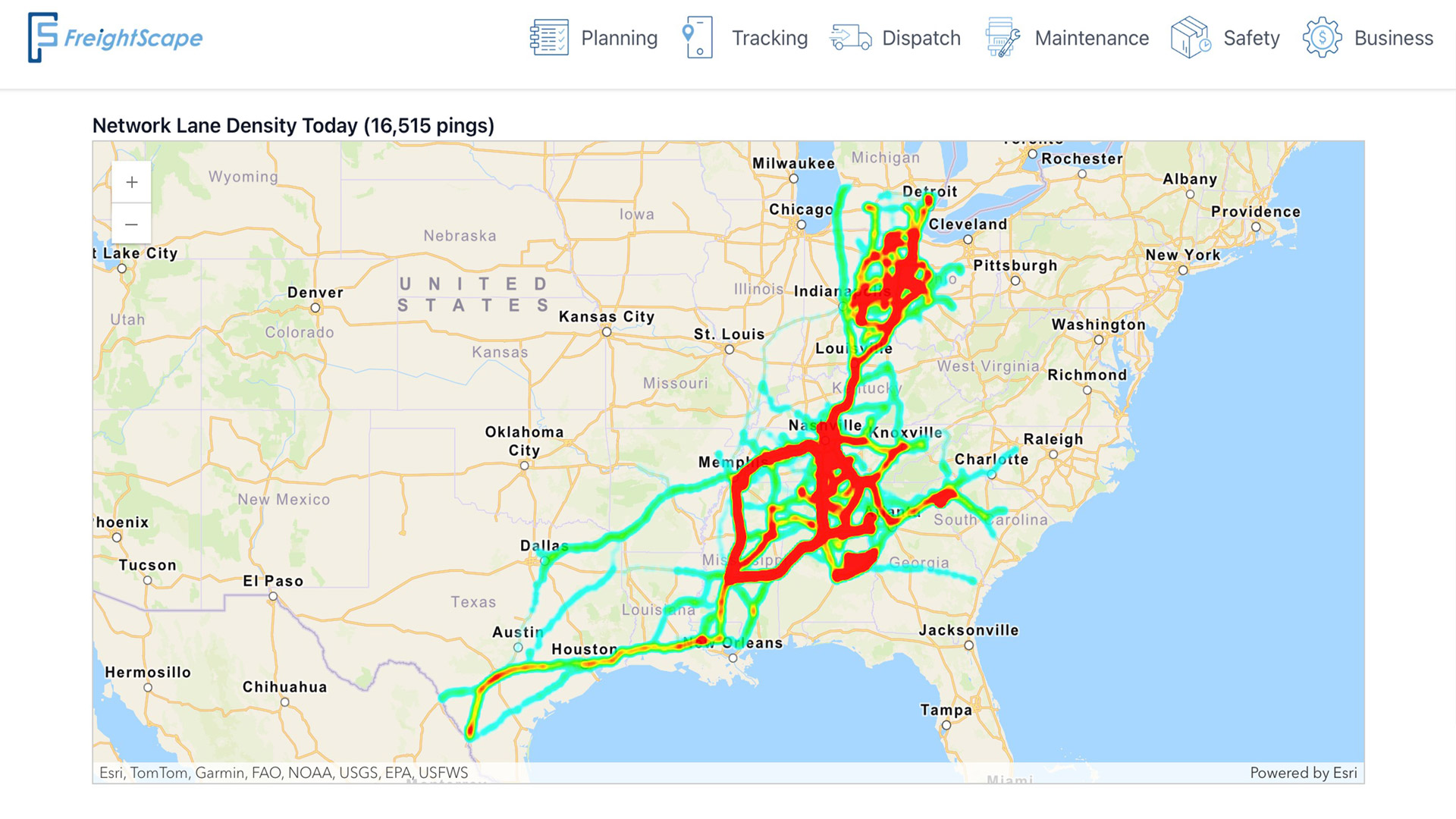
Explore the web-based fleet management platform designed by Spatial Freight Solutions to transform raw data into actionable business intelligence

Explore your options for moving published content from one organization to another.

A new open-source showcase app built with ArcGIS Maps SDK for JavaScript enables you to design projects within existing urban environments.
The Geographic Approach has been a foundational concept for decades. What’s different now is its reach and urgency.

CalHeatScore—a first-of-its-kind system—ranks heat risk on a scale from 0 to 4 at the ZIP code level, helping people know when it’s too hot.

Each year, hundreds of people around the world use ArcGIS to collect data and support demining activities, so technology training is key.

Learn the benefits and drawbacks of each option for migrating ArcGIS Online data to an enterprise geodatabase.

With the 3D object layer, not only can you host models in ArcGIS, but you can also edit these features directly on the web.

Use elevation data in ArcGIS Pro to map storm surges and predict which areas will flood when a hurricane hits.